
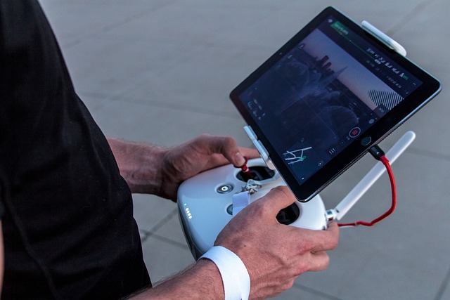
Aeronica delivers comprehensive Geographic Information System (GIS) solutions powered by advanced drone technology, AI analytics, and indigenous mapping software. Our drone-based GIS services provide high-resolution spatial data for infrastructure development, land use planning, and resource management. With Aeronica’s precision mapping and real-time geospatial intelligence, industries gain the power to visualize, analyze, and act with confidence.
Railways & Roadways

Aeronica provides cutting-edge GIS and drone mapping services for Railways and Roadways, enabling smart planning, monitoring, and maintenance of linear infrastructure networks. Using high-resolution aerial imagery, LiDAR, and RTK-enabled drones, we capture corridor data with sub-centimeter accuracy. Our GIS platforms transform this data into actionable layers depicting terrain profiles, track alignments, embankments, drainage systems, and encroachments.
For railway authorities, Aeronica delivers right-of-way (ROW) analysis, bridge and culvert inspection, station area mapping, and asset inventory management through geospatial visualization. In road infrastructure projects, we assist in alignment studies, pavement condition assessment, slope stability analysis, and traffic flow monitoring.
The integration of GIS with drone imagery supports pre-construction feasibility, mid-project progress tracking, and post-construction maintenance auditing. Our technology ensures faster survey completion, reduced ground effort, and enhanced project accuracy.
Keywords: Railway corridor mapping, roadway inspection drones, LiDAR for railways, GIS asset management, infrastructure monitoring.
Construction
Aeronica’s GIS solutions for construction and infrastructure projects revolutionize the way developers, engineers, and planners monitor progress and manage resources. By integrating drone photogrammetry, 3D mapping, and volumetric analytics, we deliver spatially accurate data that supports every stage of the construction lifecycle — from feasibility to completion.
Our drones generate orthophotos, digital terrain models (DTMs), and digital surface models (DSMs) that feed into GIS platforms for cut-and-fill analysis, site grading, excavation volume measurement, and utility network mapping. Project managers can track progress in real time, compare as-built vs. design plans, and identify deviations instantly.
With Aeronica’s GIS mapping, construction firms benefit from optimized earthwork planning, accurate material estimation, and improved safety compliance. Integration with Building Information Modeling (BIM) and Computer-Aided Design (CAD) tools ensures seamless project coordination and efficient reporting. The end result is a data-driven approach that reduces costs, delays, and manual supervision.
Keywords: Construction drone mapping, GIS for site monitoring, DTM and DSM analysis, BIM integration, volumetric drone survey.
Forest
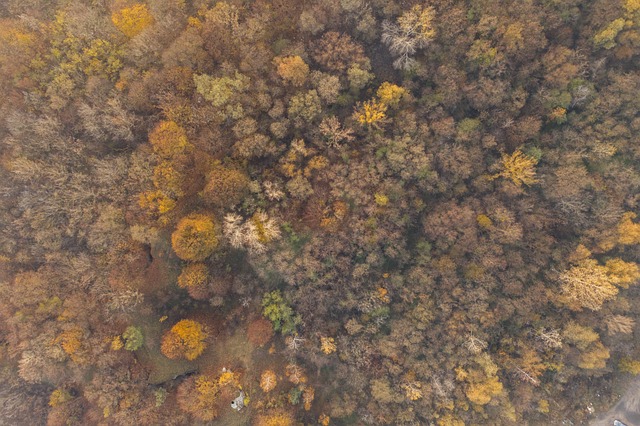
Aeronica’s Forest GIS Services empower environmental and forestry departments with precise, data-rich insights for managing natural resources and ecosystems. Using multispectral, hyperspectral, and thermal drone sensors, we capture detailed imagery that reveals forest canopy density, tree species distribution, and vegetation health indices (NDVI, SAVI, etc.).
Our GIS platforms analyze deforestation patterns, illegal encroachments, and fire-prone zones, enabling proactive decision-making and environmental conservation. Aeronica supports agencies in biodiversity mapping, carbon stock estimation, and afforestation project monitoring, contributing directly to climate resilience and sustainability initiatives.
With repeat drone flights and time-series GIS data, we provide forest change detection reports that help evaluate ecosystem health and reforestation success. Our solutions also integrate with environmental databases for real-time forest resource monitoring, offering transparency and traceability.
Keywords: Forest GIS mapping, NDVI drone survey, deforestation monitoring, environmental GIS analytics, carbon stock assessment.
GIS Survey & Mapping
At Aeronica, we specialize in GIS survey and mapping using next-generation drones and precision sensors. Our technology delivers orthomosaic imagery, contour mapping, 3D terrain modeling, and cadastral boundary digitization with exceptional accuracy. By employing RTK/PPK-enabled UAVs, we achieve positional precision within centimeters, eliminating the need for extensive manual surveying.
Our GIS data services are tailored for urban planning, land use classification, real estate documentation, and smart city development. Aeronica’s team processes aerial datasets into geo-referenced layers, compatible with popular GIS platforms like QGIS, ArcGIS, and AutoCAD Civil 3D.
We also provide digital twin creation, enabling clients to visualize terrain features and infrastructure assets in immersive 3D environments. From agricultural mapping to industrial site planning, our GIS data enhances efficiency, accuracy, and transparency.
Keywords: Drone GIS survey, cadastral mapping, RTK/PPK accuracy, orthomosaic generation, digital twin creation.
Mining
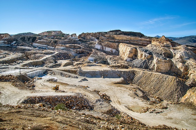
Aeronica’s GIS and drone mapping services for mining deliver accurate, safe, and efficient methods for resource evaluation, pit monitoring, and stockpile volumetrics. Traditional manual surveys in mining areas are time-consuming and hazardous — Aeronica replaces them with drone-based 3D mapping, LiDAR scanning, and photogrammetric analysis.
Our GIS-integrated workflows provide ore volume estimates, slope stability assessments, haul road optimization, and reclamation planning. The spatial data can be updated regularly to monitor mine progression, compliance with safety regulations, and environmental rehabilitation efforts.
By combining high-resolution aerial imagery with GIS analytics, Aeronica helps mining companies achieve operational transparency, resource optimization, and cost efficiency. Our systems are fully compatible with mine planning software, ensuring seamless integration with ongoing production processes.
Keywords: Mining drone survey, volumetric analysis, pit mapping, LiDAR mining inspection, GIS for resource estimation.
Powerline Transmission
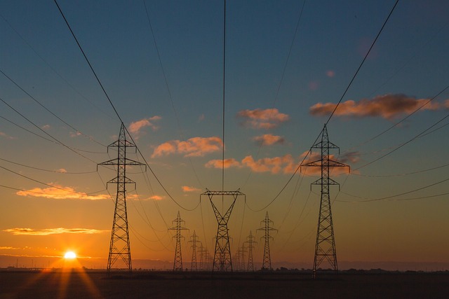
Aeronica offers specialized GIS and drone inspection solutions for power transmission and distribution networks, ensuring grid reliability and operational safety. Our drones capture high-resolution RGB, thermal, and LiDAR data for detailed inspection of towers, conductors, insulators, and right-of-way corridors.
The GIS-based analytics identify vegetation encroachments, line sag, corrosion points, and thermal hotspots, allowing utilities to perform predictive maintenance and reduce unplanned outages. Our geo-tagged data supports asset lifecycle management, route optimization, and digital mapping of power infrastructure.
Aeronica’s intelligent inspection workflow shortens downtime, minimizes manual climbing risks, and improves compliance with DGCA and CEA safety norms. The output can be integrated with existing SCADA and asset management systems for seamless decision-making.
Keywords: Powerline drone inspection, transmission GIS mapping, thermal fault detection, vegetation management, grid monitoring.
Water Resources & Irrigation
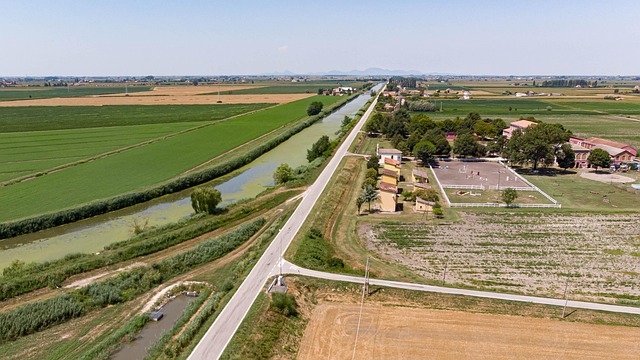
Aeronica’s GIS for water resources and irrigation provides accurate geospatial insights to support sustainable water management and agricultural planning. Our drones map dams, reservoirs, canals, river basins, and command areas using photogrammetry and LiDAR technologies, generating data for watershed modeling, flood risk mapping, and irrigation network assessment.
We create Digital Elevation Models (DEMs) and flow direction maps to help engineers design efficient irrigation layouts, optimize drainage channels, and manage catchment sedimentation. Our GIS analysis supports real-time water distribution monitoring, ensuring equitable usage and improved productivity in agriculture.
Through change detection analysis, Aeronica helps track water body shrinkage, canal breaches, and silt accumulation — essential for policy and maintenance planning. Our geospatial intelligence enables data-driven decisions that strengthen sustainability, conservation, and infrastructure resilience.
Keywords: Water resource GIS mapping, watershed analysis, irrigation drone survey, canal inspection, flood risk modeling.
